Distance: 4km
How long: 1-2 hours depending how long you stop and enjoy
How hard: East grade with minimal stairs
How to get there: Drive or take the bus to The Barracks Precinct, North Head Sanctuary, parking in Gun Park Car Park
Why do it: History, views, cafe and bush walking
HISTORIC SITES
Car-rang-gel
North Head is known as Car-rang-gel by the Gayamagal People. It was once used by their Koradgee (medicine men and women healers) for spiritual ceremonies and rituals. There are many rock engravings, rock art, campsites, burials and middens all around this area as reminders of the Gayamagal People’s connection to the area.
Army School of Artillery
The Army School of Artillery opened after WWII and housed gunners from 1946 to 1998 who lived and trained on site before the school moved to Puckapunyal, Victoria. This is now known as the Barracks Precinct where you’ll start your walk.
Australian Memorial Walkway
The Memorial Walk honours those who’ve served and supported the defence of Australia in peace or in war. The paved pathway links five monuments dedicated to the Colonial Wars, the First and Second World Wars, post-Second World War conflicts and peacekeeping with a special monument to Galipoli.
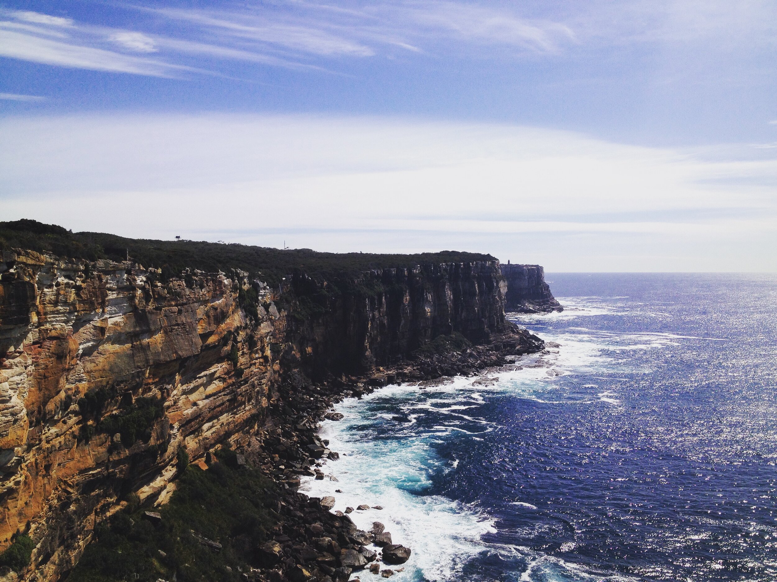
North Fort
Established in 1936, North Fort is a remnant military complex strategically placed at the northern entrance to Sydney Harbour. It was part of a defence system that spanned over 300km of coastline during World War II. Until 1952, the North Fort Battery featured two 9.2 inch calibre guns. Serviced by a 200-metre-long network of underground tunnels, each was capable of firing a distance of 26.4km. You can walk around and explore the military fortifications to this day.
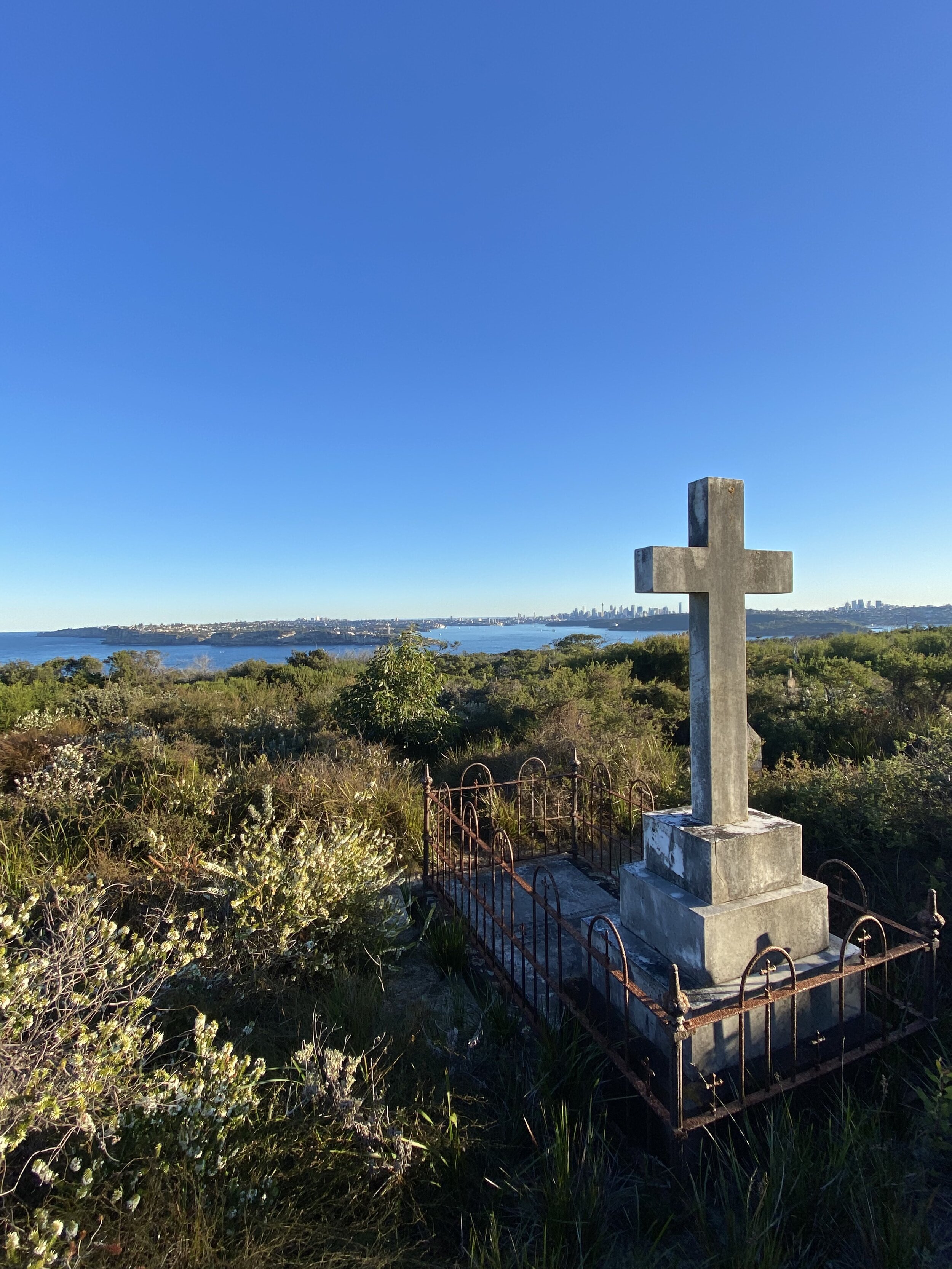
North Head Cemetery
Between 1832 when Quarantine Station was established and 1984 thousands of people were quarantined at the Station. More than 570 people died there. The North Head Cemetery was established for those people who came to Sydney and died of the bubonic plague, smallpox, scarlet fever, measles and the pneumonia influenza (or Spanish flu). They’re now resting with one of the most beautiful views of Sydney.
Click the links below to download the Bondi to Manly App to follow the maps and read more about these sites:
DIRECTIONS
Walk from Manly (adds another 1.2km each way), grab a bus or drive to The Barracks Precinct, parking in Gun Park Car Park.
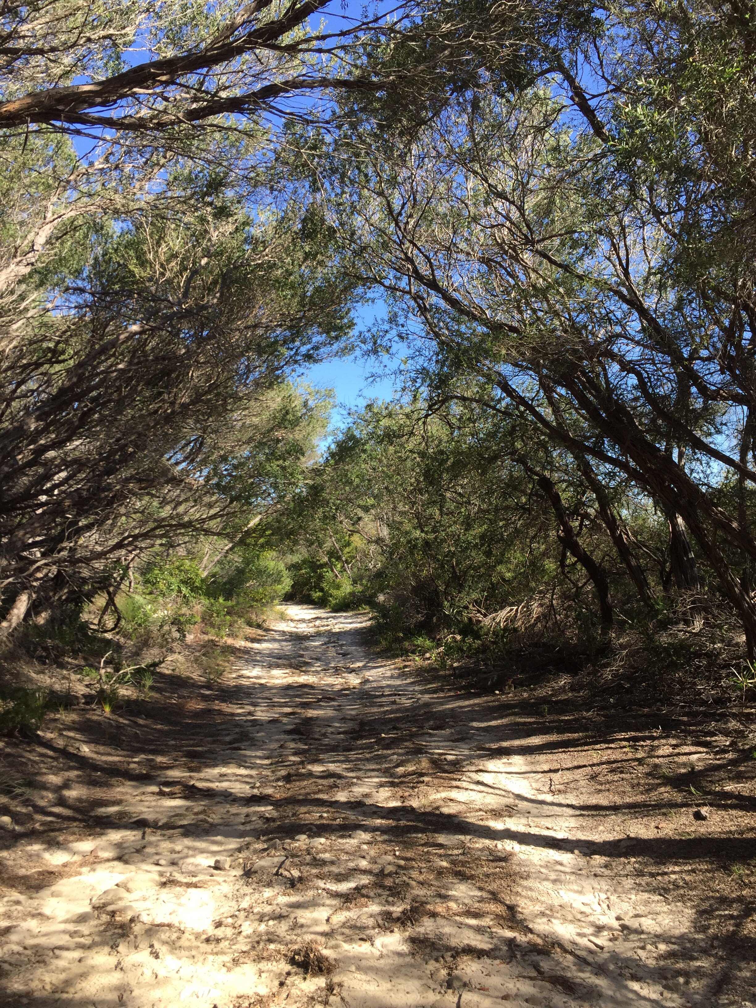
From the ‘Parade Ground’ (the big red field), join the road on the other side of the field, turn right then immediately left. After 50m, opposite the North Head Sanctuary Foundation take the dirt track on your right which turns into a raised path.
From Gun Park Car Park return to the road you just turned off then immediately take the dirt track on your left - it runs parallel to the car park and turns into a raised path.
Follow this path around North Head, following the signs for the B2M and the Fairfax Lookout.
The path will bring you out at Third Quarantine Cemetery, at this point continue straight, following the track down the stairs and through the fence to North Head Sanctuary Visitor Centre.
At the Visitor Centre, cross over the road, turning left then right down the dirt track which becomes the Memorial Walk. Follow the Memorial Walk until you see a sign to ‘Fairfax Lookout’ which directs you right down a wide rocky road.
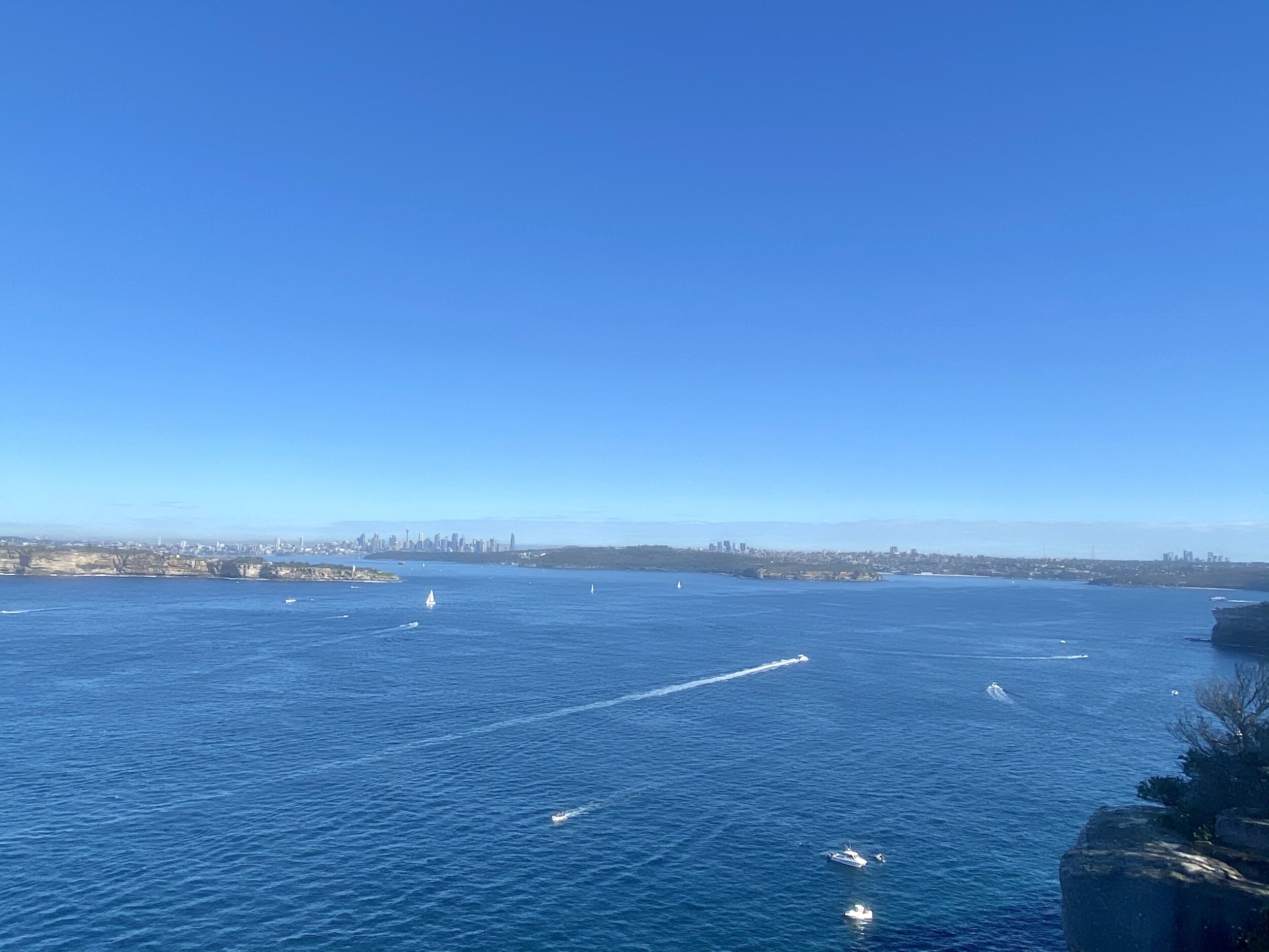
When the wide rocky path meets the bitumen road, turn left. Pass through the carpark and join the Fairfax Track, turning right at the junction to the Fairfax Track turn right to loop around the Track and give you incredible views from North Head across to South Head and Middle Head.
After completing the Fairfax Track loop, retrace your steps through the carpark and along the bitumen road to turn right back on to the wide rocky path. Once the path meets the Memorial Walk again, turn right following the Memorial Walk until you reach a gravel road. Continue right along the rocky road.
[ Unfortunately the Hanging Swamp is currently closed due to bushfire damage. ]
Continue on the rocky road for 400m then turn left up the stairs on the track signposted to Manly. Follow this track back to the Barracks and Parade Ground and return to your car / bus stop or start the walk back to Manly.
Click the map below and follow the yellow ‘WATSONS BAY LOOP’.

References:
https://www.harbourtrust.gov.au/en/our-story/harbour-history/history-of-north-head-sanctuary/
https://www.warmemorialsregister.nsw.gov.au/content/australias-memorial-walk-manly